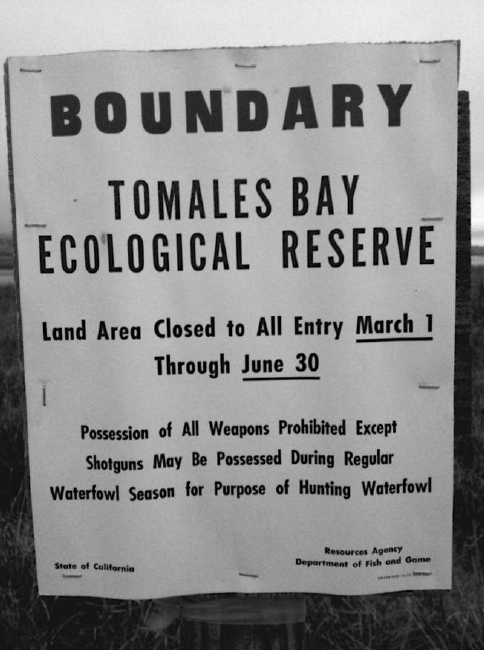
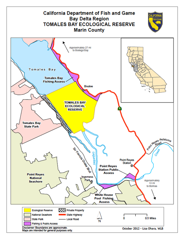
Tomales Bay Ecological Reserve Map
Revised by CA Fish and Wildlife October 2012. This identical map can be accessed on the F&W website.
Go to: www.dfg.ca.gov/lands/er/region3/tomales.html
(See explanatory paragraph below at the bottom of this page)
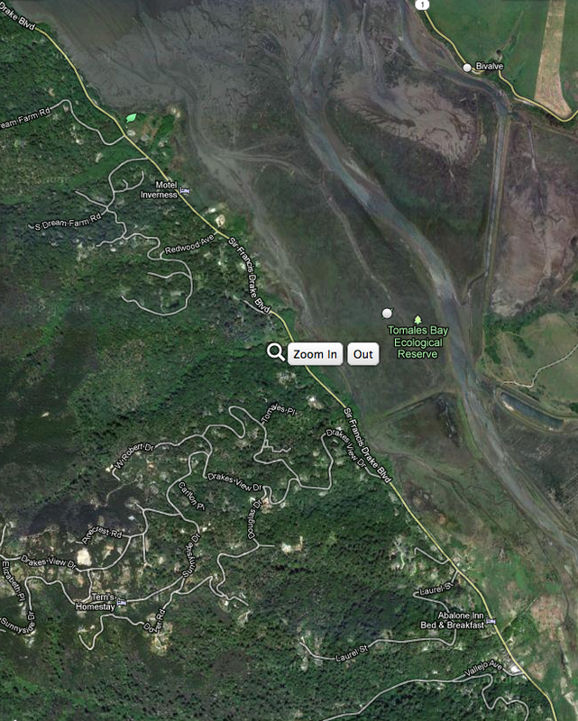
And, scroll down for Aerial Photo of Tomales Bay Ecological Reserve Area
Aerial Photo of Tomales Bay Ecological Reserve Area and Surroundings
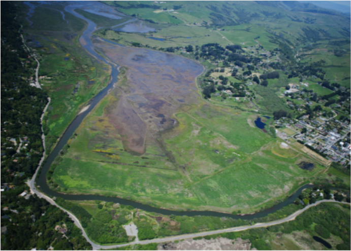
Aerial Photo of Giocomini Wetlands Looking North at Top to the TBER
While posting new CDFG signs marking the boundaries of the TBER on 10/9/12, it was discovered by a department employee that the TBER boundaries (recently shown on their old map on the CDFG website) were incorrect. The entire western border of the TBER, from north to south, which had previously been thought to be state land under the jurisdiction of F&G is, in actuality, private property. A new map has been drawn and is posted on their website at www.dfg.ca.gov/lands/er/region3/tomales.html -- walking the TBER with John Krause, CDFG Environmental Scientist, the following day to view their new signs, it was suggested by him that Action Tomales Bay attempt to contact all of the property owners along the new border to request that they post NO HUNTING/TRESPASSING signs on their properties near the Sir Francis Drake roadway. CDFG is not allowed to post the signs themselves due the private property issue. This development effectively removes any access from the west at Sir Francis Drake (from north to south) to the Ecological Reserve. The new map (link above) which shows the clearly marked PRIVATE PROPERTY zone should serve to eliminate any confusion about the boundary. Please see the "NEW TBER MAP" (above) for the full map.